
Walkway Segmentation Dataset
Home » Case Study » Walkway Segmentation Dataset
Project Overview:
Objective
To advance AI models for urban planning, augmented reality navigation, accessibility studies, and pedestrian safety, a dedicated dataset is being curated for the segmentation of walkways in various environments. This dataset aims to facilitate advancements by providing comprehensive data sets. The inclusion of transition words will help improve the flow and coherence of the content.
Scope
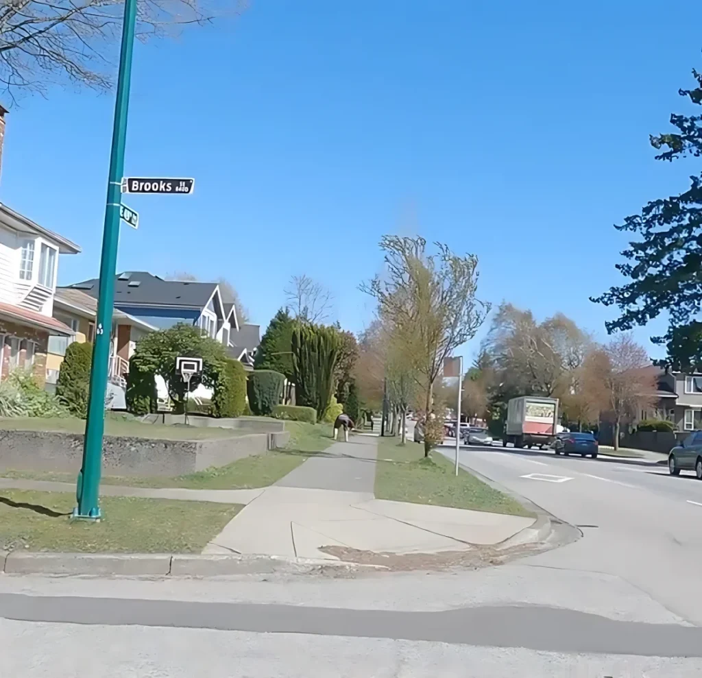
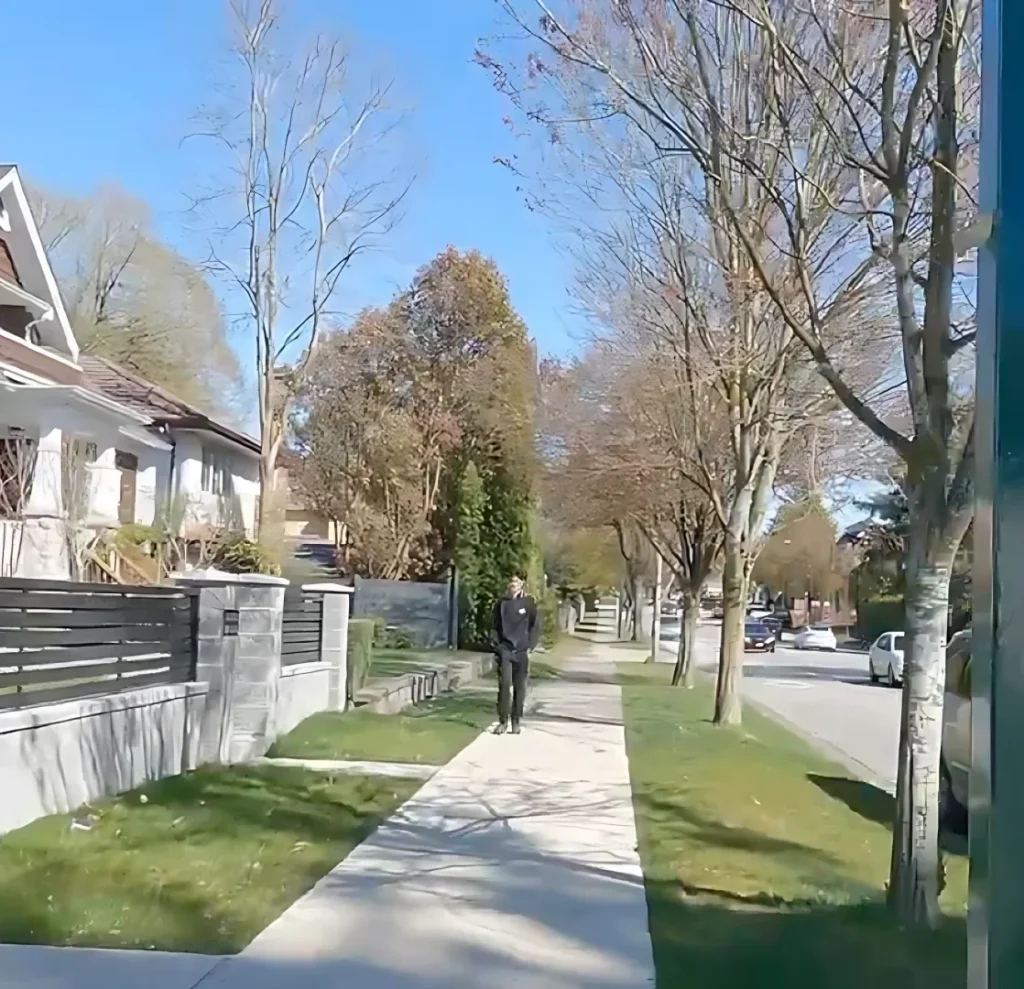
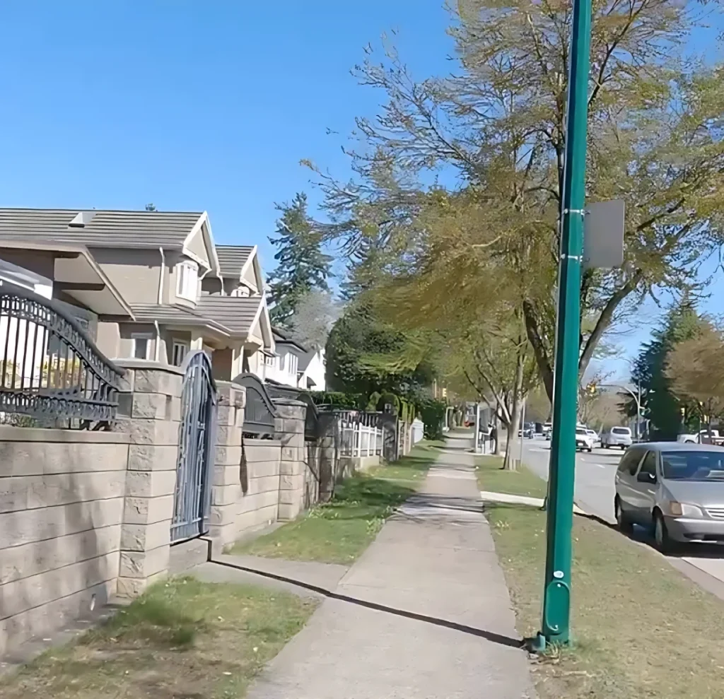
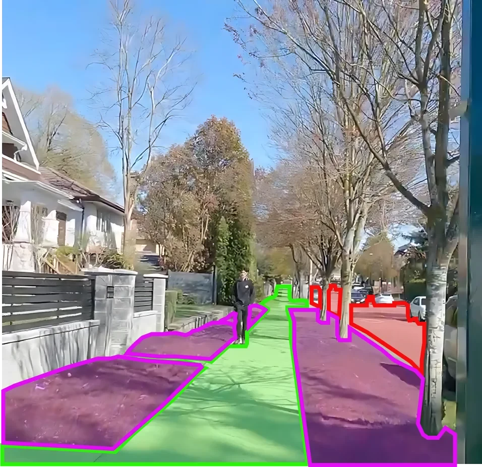
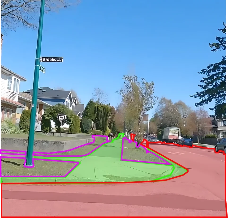
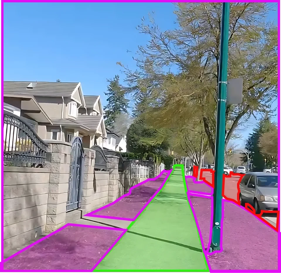
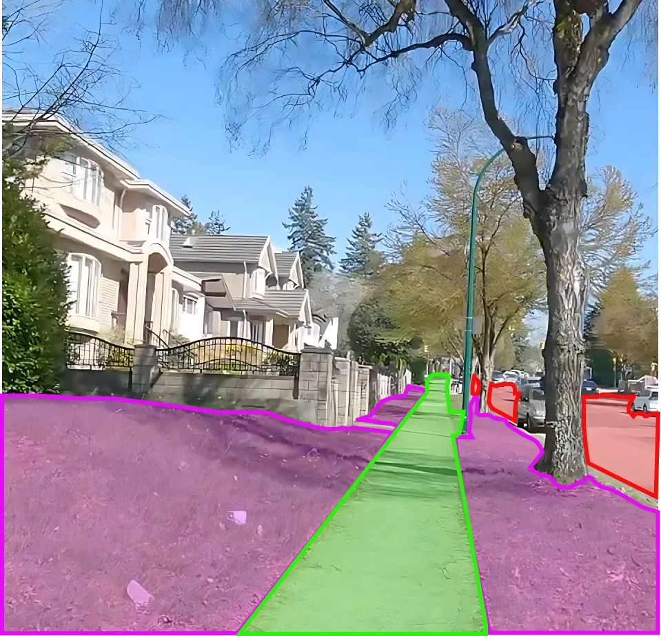
Transitioning to various settings, we present a collection of images showcasing diverse walkways, from bustling urban streets to serene parks, vibrant campuses, bustling malls, and more. Each image is annotated to pinpoint specific walkways and provide metadata regarding their material, width, and surrounding features
Sources
- Engaged in collaborative initiatives with urban planners and city councils, consequently resulting in the active collection and successful curation of urban development data.
- By incorporating contributions from tourists and travel bloggers, we’ve crafted a thoughtfully collected and diverse representation of experiences. Moreover, we’ve ensured that each perspective is actively represented, fostering a dynamic and engaging platform for exploration and discovery.
- Utilizing drone and satellite captures, we compiled a comprehensive dataset for urban analysis successfully. Moreover, we integrated various sources of data to ensure thorough coverage. Additionally, we meticulously processed the collected data for accuracy and reliability. Subsequently, we analyzed the dataset using advanced analytical techniques. Furthermore, we derived valuable insights from the analyzed data, facilitating informed decision-making in urban planning and development.
- In collaboration with landscape architects, I actively contributed to meticulously collecting and successfully curating a pool of landscape-related information. Additionally, I facilitated the organization and categorization of this data, ensuring its accessibility and usefulness to stakeholders. Moreover, I continuously updated and expanded the repository with new findings and insights.
- Ethically sourcing and thoughtfully curating public surveillance camera feeds involves ensuring appropriate permissions to carefully collect the dataset. Moreover, actively monitoring and managing these feeds is essential to maintaining their integrity. Additionally, regulating and controlling access to these feeds prevents misuse or unauthorized access. Furthermore, conducting regular audits ensures compliance with ethical standards and legal regulations. Moreover, promptly addressing and rectifying any identified issues or violations is crucial.


Data Collection Metrics
- Total Walkway Images: 350,000
- Urban Streets: 130,000
- Parks and Recreational Areas: 70,000
- Educational Campuses: 50,000
- Shopping Malls and Plazas: 40,000
- Historical Sites and Monuments: 60,000
Annotation Process
Stages
- Image Pre-processing: Adjustments for clarity, contrast, and framing.
- Walkway Segmentation: We accurately demarcate the walkway by creating segmentation masks. Additionally, we define clear boundaries and delineate paths using these masks. Moreover, we ensure precise outlining of the walkway through meticulous segmentation. Furthermore, we establish distinct separation of the walkway from its surroundings, enhancing clarity and safety.
- Metadata Annotation: We include details about the walkway material, such as asphalt, concrete, or cobblestone. Additionally, we estimate the width and identify key surrounding features, like benches and lampposts, for comprehensive annotation.
- Validation:Urban planning experts, along with preliminary walkway detection algorithms, collaboratively validate the annotations. This ensures comprehensive analysis and accurate identification of walkways within urban areas. Additionally, the integration of expert insights and algorithmic methodologies enhances the efficiency and reliability of the validation process.
Annotation Metrics
- Total Walkway Segmentation Annotations: 350,000
- Metadata Annotations: 350,000

Quality Assurance
Stages
Automated Walkway Recognition Verification: Early-stage models verify the accuracy of segmented walkways.
Peer Review: Additionally, a different set of annotators executes another round of scrutiny.
Inter-annotator Agreement: Furthermore, a fraction of the images undergoes double-checking by multiple individuals to ensure a high degree of consistency.
QA Metrics
- Annotations Validated using Walkway Recognition: 175,000 (50% of total images)
- Peer Reviewed Annotations: 105,000 (30% of total images)
- Inconsistencies Identified and Rectified: 7,000 (2% of total images)
Conclusion
The Walkway Segmentation Dataset serves as a linchpin, facilitating the comprehension of design, layout, and accessibility of pedestrian paths in diverse settings. It is positioned to revolutionize urban planning, architecture, and technology, enabling the creation of more pedestrian-friendly, navigable, and inclusive spaces. By harnessing this dataset, AI-driven tools can unveil transformative insights and solutions.

Quality Data Creation

Guaranteed TAT

ISO 9001:2015, ISO/IEC 27001:2013 Certified

HIPAA Compliance

GDPR Compliance

Compliance and Security
Let's Discuss your Data collection Requirement With Us
To get a detailed estimation of requirements please reach us.