
Sky Segmentation Dataset
Home » Case Study » Sky Segmentation Dataset
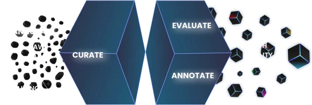
Project Overview:
Objective
Our latest project, the “Sky Segmentation Dataset,” is focused on creating a detailed dataset for training advanced machine learning models in sky segmentation. This dataset is essential for various applications, such as meteorology, aerial photography, and environmental monitoring, ensuring accurate sky detection and segmentation.
Scope
The project involves collecting and labeling sky images. Additionally, our sources include high-quality satellite images, drone photos, and pictures taken from the ground. As a result, we ensure we have a varied and large dataset.


Sources
The collection focused on gathering high-quality images that show various sky conditions.
Various landscapes and settings, including urban, rural, coastal, and mountainous areas, were included to ensure a variety of backgrounds.
Representations of different times of day and various weather conditions were focused on.
We successfully collected a complete set of images, creating visually stunning and varied pictures of sky conditions, landscapes, and atmospheric phenomena.
Data Collection Metrics
- Total Sky Images Collected: 18,000
- Satellite Imagery: 8,000
- Drone Photography: 6,000
- Ground-Level Photographs: 4,000
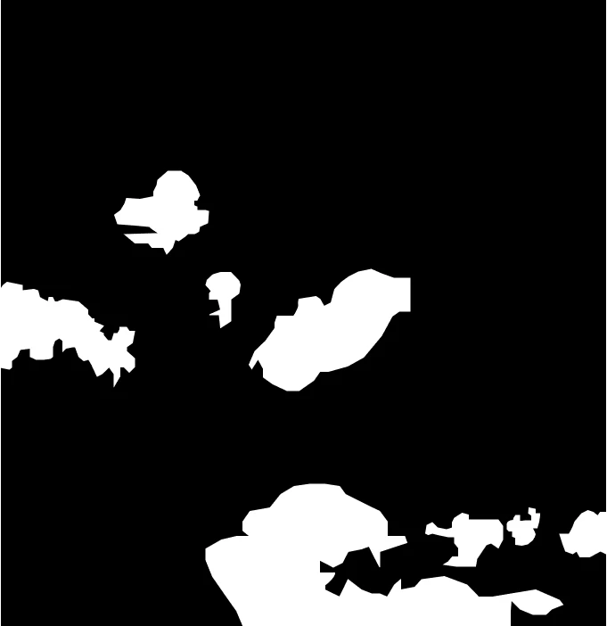
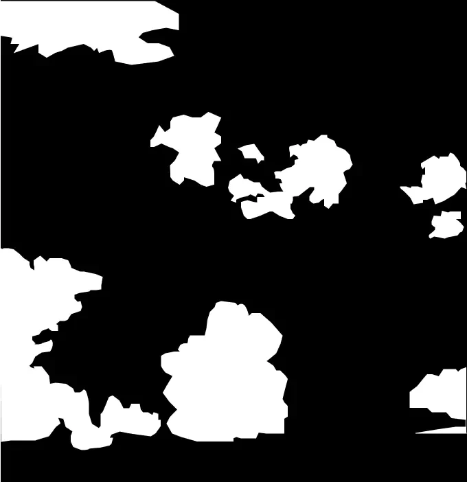
Annotation Process
Stages
- Sky Segmentation: For each image, segment the sky from other elements, such as land, water, and structures.
- Feature Tagging: Assign metadata tags to each image. These tags should include the time of day, weather conditions, and geographical location.
Annotation Metrics
- Images with Sky Segmentation Labels: 18,000
- Metadata Tagging: 15,000


Quality Assurance
Stages
- Segmentation Verification: Implement a thorough verification process to ensure the accuracy of sky segmentation in each image. This includes using advanced algorithms and manual review to validate the segmented regions.
- Data Quality Control: Maintain high standards by removing images that do not meet our quality criteria. This includes checking for clarity, resolution, and relevance. Regular audits will help in identifying and discarding poor-quality images.
- Data Security: Uphold strict data privacy standards and ensure all collected images comply with legal and ethical guidelines. Implement robust security measures to protect the data from unauthorized access and breaches.
QA Metrics
- Segmentation Validation Cases: 3,500
- Data Cleansing: Ongoing removal and refinement of dataset contents
Conclusion
The “Sky Segmentation Dataset” is a key resource for improving technologies in environmental monitoring, meteorology, and aerial imaging. By offering a dataset with carefully labeled sky images, we enable the creation of machine learning models that can accurately identify and segment sky elements. Therefore, this dataset highlights our dedication to providing top-quality, diverse, and ready-to-use datasets for various technological advancements.

Quality Data Creation

Guaranteed TAT

ISO 9001:2015, ISO/IEC 27001:2013 Certified

HIPAA Compliance

GDPR Compliance

Compliance and Security
Let's Discuss your Data collection Requirement With Us
To get a detailed estimation of requirements please reach us.