
VSAI Dataset
Home » Dataset Download » VSAI Dataset
VSAI Dataset
Datasets
VSAI Dataset
File
VSAI Dataset
Use Case
VSAI Dataset
Description
Explore the VSAI Dataset, featuring 49,712 annotated vehicle instances from high-resolution aerial imagery. Captured using drones across diverse conditions, this dataset supports advanced vehicle detection models.
Description:
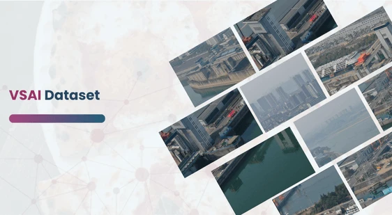
The VSAI (Vehicle Surveillance via Aerial Imagery) Dataset is a highly versatile and expansive collection of high-resolution aerial images gathered from multiple drone platforms. Covering a diverse geographical expanse, this dataset is specifically curated to support vehicle detection tasks in various complex real-world environments. It offers a multi-view perspective of different urban and rural areas, captured under a wide range of conditions.
This unique dataset is designed for advancing object detection in aerial imagery by addressing numerous real-world challenges, such as varying camera angles, diverse flight altitudes, changing weather conditions, and fluctuating light intensities. VSAI captures imagery from different times of the day and seasons, making it an essential resource for building more robust vehicle detection models.
Download Dataset
Dataset Composition
The VSAI dataset contains an impressive 49,712 vehicle instances meticulously annotated using oriented bounding boxes and arbitrary quadrilateral bounding boxes. This level of precision in annotation accommodates varying object shapes and positions in aerial views, enhancing the dataset’s utility for training advanced object detection algorithms. It includes annotations for:
- Small Vehicles: 47,519 instances
- Large Vehicles: 2,193 instances
To enhance model robustness, the dataset also includes detailed annotations of occlusion rates, helping algorithms generalize better under challenging scenarios like partial visibility caused by environmental factors or other objects.
Key Features
- Diverse Capture Conditions: The images in VSAI are captured across multiple drone platforms, which vary in altitude, camera angles, and flight paths.
- Complex Scenarios: The dataset spans a wide range of environments, including urban centers, rural landscapes, industrial areas, and highways, representing real-world complexities.
- Varied Temporal and Weather Conditions: Images have been captured during different times of the day and under diverse weather conditions, including clear skies, overcast, rainy, and foggy environments.
- High Annotation Accuracy: Vehicle instances are annotated with highly precise bounding boxes, including both oriented and arbitrary quadrilateral shapes, to reflect the true contours of vehicles as seen from an aerial perspective.
- Occlusion Annotation: Objects in the dataset are also labeled with their occlusion levels, providing additional challenges for model training and improving detection performance in scenarios with partially visible vehicles.
This dataset is sourced from Kaggle.
Contact Us

Quality Data Creation

Guaranteed TAT

ISO 9001:2015, ISO/IEC 27001:2013 Certified

HIPAA Compliance

GDPR Compliance

Compliance and Security
Let's Discuss your Data collection Requirement With Us
To get a detailed estimation of requirements please reach us.