
Urban Visual Pollution Dataset
Home » Dataset Download » Urban Visual Pollution Dataset
Urban Visual Pollution Dataset
Datasets
Urban Visual Pollution Dataset
File
Urban Visual Pollution
Use Case
Urban Visual Pollution
Description
Explore the Urban Visual Pollution Dataset, a large-scale collection of street imagery capturing various visual pollutants like graffiti, potholes, and more.
Description:
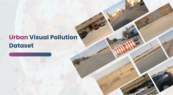
The Urban Visual Pollution Dataset is designed for the detection and evaluation of various visual pollutants present in urban environments. This dataset comprises street-level imagery captured by cameras mounted on moving vehicles, offering a comprehensive view of visual pollution in a specific urban area. As visual pollution becomes an increasingly recognized issue, this dataset provides a foundation for pioneering research and development in environmental management and urban planning.
Objective
The primary goal of this dataset is to support the development of automated systems for visual pollution classification. By leveraging convolutional neural networks (CNNs), researchers and developers can simulate human-like image recognition capabilities to identify and classify different types of visual pollutants. This work is essential for creating a “visual pollution score/index,” a new metric that could become integral to urban environmental management. The dataset not only fosters innovation in AI and computer vision but also contributes to the broader understanding and mitigation of urban visual pollution.
Download Dataset
Visual Pollution Types
The dataset covers a wide range of visual pollution categories, reflecting the diverse challenges faced by urban environments. These include:
- Graffiti: Unauthorized art or vandalism on public or private property.
- Faded Signage: Deteriorating signs that contribute to a neglected appearance.
- Potholes: Surface depressions in roadways that can cause vehicle damage and accidents.
- Garbage: Litter and improperly disposed waste in public areas.
- Construction Road: Temporary or abandoned construction sites that disrupt the urban landscape.
- Broken Signage: Damaged signs that may pose safety hazards and detract from the urban environment.
- Bad Streetlight: Faulty or insufficient street lighting that affects visibility and safety.
- Bad Billboard: Deteriorated or poorly maintained billboards that contribute to visual clutter.
- Sand on Road: Accumulations of sand or debris that can obscure road markings and pose driving hazards.
- Cluttered Sidewalk: Overcrowded pedestrian pathways with obstacles such as street vendors, debris, or parked vehicles.
- Unkept Facade: Building exteriors that are poorly maintained, contributing to a dilapidated urban appearance.
Dataset Composition
This dataset is composed of raw sensor camera inputs collected by a fleet of vehicles operating within a restricted geographic area in the Kingdom of Saudi Arabia (KSA). The imagery captures a wide array of urban scenes under different lighting and weather conditions, providing a robust dataset for training and testing machine learning models.
Applications and Use Cases
- Automated Visual Pollution Detection: Training AI models to automatically identify and categorize visual pollutants in urban environments.
- Urban Environmental Management: Developing tools to assess and mitigate visual pollution, leading to better urban planning and policy-making.
- Public Awareness and Engagement: Creating platforms to raise awareness about visual pollution and encourage community-driven efforts to improve urban aesthetics.
- Safety and Maintenance: Enhancing urban safety by identifying and addressing hazards like potholes, broken signage, and bad street lighting.
Potential Impact
The Urban Visual Pollution Dataset is poised to play a crucial role in shaping the future of urban environmental management. By enabling the development of sophisticated tools for detecting and evaluating visual pollution, this dataset supports efforts to create cleaner, safer, and more aesthetically pleasing urban spaces. The introduction of a visual pollution index could become a standard metric in urban planning, guiding interventions and policies to improve the quality of life in cities worldwide.
Future Directions
Future research could expand this dataset to include more geographic areas, different urban environments, and additional types of visual pollutants. There is also potential for integrating this dataset with other environmental data, such as air and noise pollution, to develop comprehensive urban health indices.
Conclusion
The Urban Visual Pollution Dataset is a critical resource for advancing the field of urban environmental management. By providing high-quality, diverse data, it empowers researchers and practitioners to address the growing challenge of visual pollution in cities, ultimately contributing to the development of more livable urban environments.
This dataset is sourced from Kaggle.
Contact Us

Quality Data Creation

Guaranteed TAT

ISO 9001:2015, ISO/IEC 27001:2013 Certified

HIPAA Compliance

GDPR Compliance

Compliance and Security
Let's Discuss your Data collection Requirement With Us
To get a detailed estimation of requirements please reach us.