
Underpass Image Dataset
Home » Dataset Download » Underpass Image Dataset
Underpass Image Dataset
Datasets
Underpass Image Dataset
File
Underpass Image Dataset
Use Case
Underpass Image Dataset
Description
Explore the Underpass Image Dataset featuring over 1,000 HD images from 200+ global locations. Ideal for autonomous driving, urban infrastructure analysis.
Description:
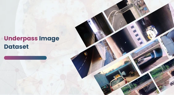
The Underpass Image Dataset consists of a diverse and comprehensive collection of over 1,000 high-quality images of underpasses from various cities across the globe. The dataset was collected through crowdsourcing efforts from more than 200 distinct locations, ensuring geographical and environmental diversity. Each image in the dataset has been meticulously reviewed and validated by a team of experts in computer vision at Datacluster Labs, ensuring accuracy and relevance.
This dataset captures underpasses under various conditions, making it particularly useful for urban scene classification, object detection, and road structure analysis. It has broad applicability in autonomous vehicle development, road safety analysis, and infrastructure management. The inclusion of various lighting conditions, distances, and viewpoints provides valuable insights for training machine learning models in real-world scenarios.
Download Dataset
Key Dataset Features
- Number of Images: 1,000+ high-resolution images.
- Data Collection Method: Crowdsourced from 200+ contributors, ensuring extensive coverage and diversity.
- Resolution: Images captured in HD and above, starting from 1920×1080, ensuring high clarity for accurate analysis.
- Locations Covered: 200+ underpass locations across urban and rural environments.
- Diversity: Images feature a wide range of lighting conditions (daylight, nighttime, shadows), varied distances, multiple angles, and viewpoints.
- Capture Devices: Primarily captured using smartphones and other portable devices between 2020 and 2022.
- Application: Ideal for training AI systems for underpass identification, scene understanding, infrastructure management, and integration into autonomous driving models.
Additional Dataset Characteristics
- Environmental Diversity: The dataset incorporates images taken under diverse environmental conditions such as rain, fog, and bright sunshine, making it a robust tool for AI model development.
- Urban vs. Rural: It contains both urban and suburban underpasses, providing a comprehensive view of different structural designs and road environments.
- Annotations: Each image is meticulously annotated to enable high-quality scene understanding for autonomous vehicles, enabling models to detect underpasses in real-time while navigating roadways.
Annotation Formats Available
- COCO
- YOLO
- PASCAL-VOC
- TFRecord
This dataset is sourced from Kaggle.
Contact Us

Quality Data Creation

Guaranteed TAT

ISO 9001:2015, ISO/IEC 27001:2013 Certified

HIPAA Compliance

GDPR Compliance

Compliance and Security
Let's Discuss your Data collection Requirement With Us
To get a detailed estimation of requirements please reach us.