
SkyFusion: Aerial Object Detection
Home » Dataset Download » SkyFusion: Aerial Object Detection
SkyFusion: Aerial Object Detection
Datasets
SkyFusion: Aerial Object Detection
File
SkyFusion: Aerial Object Detection
Use Case
Computer Vision
Description
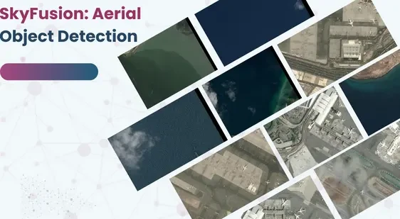
Introducing the SkyFusion dataset, designed for detecting tiny objects in satellite images. While many datasets focus on larger structures
About Dataset
Introducing the SkyFusion dataset, designed for detecting tiny objects in satellite images. While many datasets focus on larger structures, SkyFusion addresses the gap for smaller classes like cars, trucks, ships, and airplanes. It’s based on AiTOD v2 annotations, emphasizing vehicles and ships, complemented by the Airbus Aircraft Detection dataset to balance classes.
Dataset Base: AiTOD v2 and Airbus Aircraft Detection
Classes: Vehicles , Ships, Aircraft
Annotation Format – MS-COCO json
Annotation Type – Horizontal Bounding Boxes (HBB)
The original AI-TOD dataset is substantial, with 28,036 images featuring 700,621 objects across 8 classes, annotated with Horizontal Bounding Boxes (HBB). However, its size makes training on free-tier platforms impractical. To enhance accessibility, we’ve carefully curated a subset for research and development in tiny object detection.
This subset underwent compression and annotation refinement on Roboflow, resulting in a condensed, well-annotated dataset ready for publication on Kaggle. SkyFusion provides a valuable resource for researchers and developers aiming to advance tiny object detection in satellite imagery.
Applications of SkyFusion
Urban Planning
In urban planning, SkyFusion provides detailed insights into the spatial distribution of buildings and infrastructure. Planners can use this information to optimize land use, design efficient transportation networks, and enhance city management.
Agriculture
SkyFusion is transforming agriculture by providing farmers with detailed images of their fields. This technology helps in monitoring crop health, assessing soil conditions, and identifying areas that need attention. As a result, farmers can make data-driven decisions to improve yield and efficiency.
Environmental Monitoring
Environmental monitoring is another key application of SkyFusion. It enables the detection of changes in natural landscapes, such as deforestation or water body alterations. This information is vital for conservation efforts and sustainable development.
Benefits of SkyFusion
Accuracy and Efficiency
SkyFusion’s advanced algorithms and high-resolution imagery provide unmatched accuracy in object detection. This precision reduces the time and resources required for manual surveys and inspections.
Cost-Effective Solutions
By automating the process of aerial object detection, SkyFusion offers cost-effective solutions for various industries. It minimizes the need for on-ground personnel and reduces operational costs.
Enhanced Decision Making
With SkyFusion, decision-makers have access to detailed, real-time data. This information empowers them to make informed decisions quickly and confidently.
Conclusion
SkyFusion is revolutionizing the field of aerial object detection with its cutting-edge technology and diverse applications. From urban planning to agriculture and environmental monitoring, SkyFusion offers accurate, efficient, and cost-effective solutions. Embrace the future of aerial object detection with SkyFusion and transform your approach to data-driven decision making.
This dataset is sourced from Kaggle.
Contact Us

Quality Data Creation

Guaranteed TAT

ISO 9001:2015, ISO/IEC 27001:2013 Certified

HIPAA Compliance

GDPR Compliance

Compliance and Security
Let's Discuss your Data collection Requirement With Us
To get a detailed estimation of requirements please reach us.