
Ships Image Dataset
Home » Dataset Download » Ships Image Dataset
Ships Image Dataset
Datasets
Ships Image Dataset
File
Ships Image Dataset
Use Case
Ships Image Dataset
Description
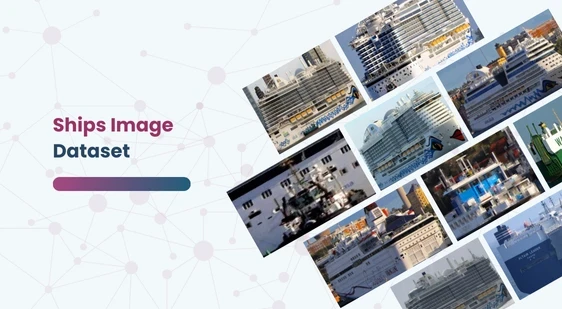
Explore our Ships Image Dataset, featuring 8,506 high-quality images and YOLO v5 annotations. Ideal for AI model training in ship detection and classification.
Description:
The Ships Image Dataset is meticulously curated to aid in the development and testing of AI models for ship detection and classification. This comprehensive dataset contains a diverse collection of ship images, ensuring robustness and accuracy in AI model training.
Download Dataset
Data Description
- Total Images: The dataset comprises 8,506 high-quality images.
- Annotation Format: Ship annotations are provided in YOLO v5 PyTorch format, making it convenient for users to implement YOLO-based object detection models.
- Pre-processing Applied:
- Auto-orientation of pixel data to ensure uniformity (EXIF-orientation stripping applied).
- Resized to a consistent dimension of 600×416 pixels (stretching applied to fit this size).
- Augmentation Techniques:
- Each source image has three augmented versions.
- 50% probability of a horizontal flip to introduce variability.
- Random Gaussian blur applied with a blur radius ranging from 0 to 3.75 pixels, enhancing the dataset’s versatility.
Classes
The dataset includes images of ships classified into the following categories:
- Aircraft Carrier
- Bulkers
- Car Carrier
- Container Ship
- Cruise
- Destroyer (DDG)
- Recreational
- Sailboat
- Submarine
- Tugboat
Inspiration
The primary goal of this dataset is to explore and enhance AI’s capabilities in detecting and classifying different types of ships in images. By leveraging this dataset, researchers and developers can create sophisticated models that can accurately identify various ship types, contributing to advancements in maritime surveillance, transportation, and security.
Use Cases
- Maritime Surveillance: Enhancing monitoring systems for coastal and international waters.
- Navigation and Safety: Assisting in the development of autonomous navigation systems for ships.
- Environmental Monitoring: Tracking and managing maritime traffic to minimize environmental impact.
- Military Applications: Improving the identification and tracking of naval vessels for defense purposes.
Acknowledgements
Special thanks to the Roboflow team for their significant contributions in sharing this valuable data, making it accessible for researchers and developers to drive innovations in the maritime domain.
This dataset is sourced from Kaggle.
Contact Us

Quality Data Creation

Guaranteed TAT

ISO 9001:2015, ISO/IEC 27001:2013 Certified

HIPAA Compliance

GDPR Compliance

Compliance and Security
Let's Discuss your Data collection Requirement With Us
To get a detailed estimation of requirements please reach us.