Semantic Segmentation Drone Dataset

Semantic Segmentation Drone Dataset

Datasets

Semantic Segmentation Drone Dataset

File

Semantic Segmentation Drone Dataset

Use Case

Computer Vision

Description

Discover the LEGO Minifigure Faces dataset, a curated collection of 800 annotated images for facial recognition tasks.
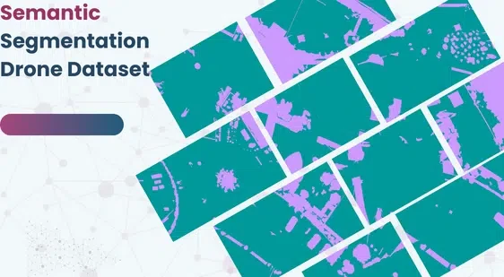
Semantic Segmentation Drone Dataset

About Dataset

The dataset is an extension of the Semantic Drone Dataset of Institute of Computer Graphics and Vision at the Graz University of Technology.

Binary and 5-class Extension

The extension proposes two different preprocessed datasets in order to perform binary segmentation and multi-class segmentation with 5 macro-groups instead of the original 24 labels and a resolution of 960x736px instead of 6000x4000px.

Colormaps and Re-labeling

All the information relative to the colors assigned to each class are contained in the colormaps.xlsx file and in addition to it there are also the conversion dictionaries used to convert the labels in classes_dict.txt.

Original Dataset

The original dataset with 24 different classes and 24Mpx of resolution is contained in the folder semantic drone dataset

Questions and Comments

Leave an up-vote if you are going to use this dataset or leave a comment/suggestion on how I could improve the documentation, if you have questions feel free to ask.

This dataset is sourced from Kaggle.

Contact Us

Technology

Quality Data Creation

Technology

Guaranteed TAT

Technology

ISO 9001:2015, ISO/IEC 27001:2013 Certified

Technology

HIPAA Compliance

Technology

GDPR Compliance

Technology

Compliance and Security

Let's Discuss your Data collection Requirement With Us

To get a detailed estimation of requirements please reach us.

{ "@context": "https://schema.org", "@graph": [ { "@type": "Service", "serviceType": "Custom AI Training Data & Annotation", "name": "Custom Drone Imagery Segmentation and Classification", "description": "Providing custom, high-accuracy, annotated drone imagery datasets for training AI/ML models in aerial mapping, urban planning, and environmental monitoring requiring semantic segmentation.", "provider": { "@type": "Organization", "name": "GTS", "url": "https://gts.ai/", "logo": "https://gts.ai/wp-content/themes/mx/images/logo.png" }, "areaServed": "Global", "serviceOutput": "Annotated Aerial Image Dataset for Semantic Segmentation", "url": "https://gts.ai/dataset-download/semantic-segmentation-drone-dataset/" }, { "@type": "Organization", "name": "GLOBOSE TECHNOLOGY SOLUTIONS PRIVATE LIMITED", "url": "https://gts.ai/", "logo": "https://gts.ai/wp-content/themes/mx/images/logo.png", "contactPoint": { "@type": "ContactPoint", "contactType": "customer service", "telephone": "+91-9269795291", "email": "hi@gts.ai" } }, { "@type": "BreadcrumbList", "itemListElement": [ { "@type": "ListItem", "position": 1, "name": "Home", "item": "https://gts.ai/" }, { "@type": "ListItem", "position": 2, "name": "Dataset Download", "item": "https://gts.ai/dataset-download" }, { "@type": "ListItem", "position": 3, "name": "Semantic Segmentation Drone Dataset", "item": "https://gts.ai/dataset-download/semantic-segmentation-drone-dataset/" } ] }, { "@type": "Dataset", "name": "Semantic Segmentation Drone Dataset (Extended)", "description": "An extension of the Semantic Drone Dataset offering preprocessed versions for binary and 5-class multi-class segmentation, featuring a reduced resolution of 960x736px for easier ML training.", "url": "https://gts.ai/dataset-download/semantic-segmentation-drone-dataset/", "keywords": [ "Semantic Segmentation Drone Dataset", "datasets for computer vision", "data collection", "dataset for ml", "Aerial Imagery", "Semantic Segmentation", "Drone Data" ], "license": "https://creativecommons.org/publicdomain/zero/1.0/", "creator": { "@type": "Organization", "url": "https://gts.ai/", "logo": "https://gts.ai/wp-content/themes/mx/images/logo.png", "name": "GTS" }, "publisher": { "@type": "Organization", "name": "GLOBOSE TECHNOLOGY SOLUTIONS PRIVATE LIMITED" }, "distribution": { "@type": "DataDownload", "encodingFormat": "PNG/JSON", "contentUrl": "https://gts.ai/dataset-download/semantic-segmentation-drone-dataset/" } }, { "@type": "FAQPage", "mainEntity": [ { "@type": "Question", "name": "What is the key feature of the Semantic Segmentation Drone Dataset extension?", "acceptedAnswer": { "@type": "Answer", "text": "The key feature is the provision of preprocessed versions for binary and 5-class multi-class segmentation, reducing the original 24 classes and lowering the resolution to 960x736px for efficient machine learning training." } }, { "@type": "Question", "name": "What is semantic segmentation and how is it used in drone imagery?", "acceptedAnswer": { "@type": "Answer", "text": "Semantic segmentation is pixel-level classification. In drone imagery, it is used to precisely identify and map objects like buildings, roads, trees, and cars for applications in urban planning and environmental monitoring." } }, { "@type": "Question", "name": "What is the difference between the original and extended dataset resolutions?", "acceptedAnswer": { "@type": "Answer", "text": "The original Semantic Drone Dataset has a high resolution of 6000x4000px (24MPx). The extended versions are scaled down to 960x736px to decrease training time and resource requirements." } }, { "@type": "Question", "name": "Can GTS create custom, high-resolution segmentation datasets for specific drone project locations?", "acceptedAnswer": { "@type": "Answer", "text": "Yes, GTS specializes in collecting and annotating custom high-resolution aerial imagery for specific regions or classification requirements. We can also share a free sample based on your custom segmentation project needs." } } ] } ] }
Scroll to Top

Please provide your details to download the Dataset.