Oil Spill Classification

Oil Spill Classification

Datasets

Oil Spill Classification

File

Oil Spill Classification

Use Case

Oil and Gas

Description

The dataset was developed by starting with satellite images of the ocean, some of which contain an oil spill and some that do not.

About Dataset

Oil Spill Classification

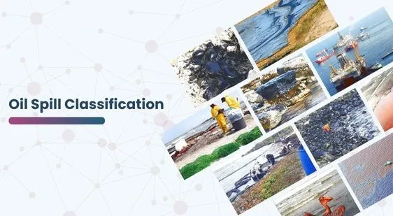
The dataset was meticulously developed using high-resolution satellite images of the ocean. Initially, these images were collected over various periods and regions, capturing a diverse array of oceanic conditions. Among these images, some depicted oil spills caused by either illegal or accidental dumping of oil into the ocean. On the other hand, others showed pristine ocean surfaces without any contamination.

To enhance the analysis and utility of these images, we divided each one into smaller sections or patches. This segmentation process enabled a more detailed examination of specific areas within the larger images. Then, we subjected these patches to advanced computer vision algorithms, which meticulously analyzed the visual data. The algorithms processed the images to extract a comprehensive vector of features, effectively summarizing the contents of each patch. These feature vectors encapsulated various aspects of the image patches, such as color, texture, shape, and other relevant visual attributes.

To distinguish between spill and non-spill using the features for a given ocean patch, it is essential to address two key issues:

Non-Spill: negative case, or majority class.
Oil Spill: positive case, or minority class.

This dataset is sourced from Kaggle.

Contact Us

Technology

Quality Data Creation

Technology

Guaranteed TAT

Technology

ISO 9001:2015, ISO/IEC 27001:2013 Certified

Technology

HIPAA Compliance

Technology

GDPR Compliance

Technology

Compliance and Security

Let's Discuss your Data collection Requirement With Us

To get a detailed estimation of requirements please reach us.

{ "@context": "https://schema.org", "@graph": [ { "@type": "Service", "serviceType": "Custom AI Training Data & Satellite Imagery Analysis", "name": "Oil Spill Classification Dataset Service", "description": "Providing feature vectors derived from high-resolution satellite images for training AI models to classify and detect oil spills in oceanic environmental monitoring applications.", "provider": { "@type": "Organization", "name": "GTS", "url": "https://gts.ai/", "logo": "https://gts.ai/wp-content/themes/mx/images/logo.png" }, "areaServed": "Global", "serviceOutput": "Feature Vector Dataset for Binary Classification (Oil Spill Detection)", "url": "https://gts.ai/dataset-download/oil-spill-classification/" }, { "@type": "Organization", "name": "GLOBOSE TECHNOLOGY SOLUTIONS PRIVATE LIMITED", "url": "https://gts.ai/", "logo": "https://gts.ai/wp-content/themes/mx/images/logo.png", "contactPoint": { "@type": "ContactPoint", "contactType": "customer service", "telephone": "+91-9269795291", "email": "hi@gts.ai" } }, { "@type": "BreadcrumbList", "itemListElement": [ { "@type": "ListItem", "position": 1, "name": "Home", "item": "https://gts.ai/" }, { "@type": "ListItem", "position": 2, "name": "Dataset Download", "item": "https://gts.ai/dataset-download" }, { "@type": "ListItem", "position": 3, "name": "Oil Spill Classification", "item": "https://gts.ai/dataset-download/oil-spill-classification/" } ] }, { "@type": "Dataset", "name": "Oil Spill Classification Feature Vector Dataset", "description": "A dataset derived from high-resolution satellite images, containing extracted feature vectors (color, texture, shape) of ocean patches for binary classification: identifying oil spills (minority class) versus non-spill areas (majority class).", "url": "https://gts.ai/dataset-download/oil-spill-classification/", "keywords": [ "Oil Spill Classification", "Satellite Imagery Dataset", "Feature Vector ML", "Environmental Monitoring AI", "Imbalanced Classification", "Remote Sensing" ], "license": "https://creativecommons.org/publicdomain/zero/1.0/", "creator": { "@type": "Organization", "url": "https://gts.ai/", "logo": "https://gts.ai/wp-content/themes/mx/images/logo.png", "name": "GTS" }, "publisher": { "@type": "Organization", "name": "GLOBOSE TECHNOLOGY SOLUTIONS PRIVATE LIMITED" }, "distribution": { "@type": "DataDownload", "encodingFormat": "CSV/JSON", "contentUrl": "https://gts.ai/dataset-download/oil-spill-classification/" } }, { "@type": "FAQPage", "mainEntity": [ { "@type": "Question", "name": "What type of data is contained in the Oil Spill Classification dataset?", "acceptedAnswer": { "@type": "Answer", "text": "The dataset contains **feature vectors** extracted from small ocean patches of high-resolution satellite images. These vectors summarize visual attributes like color, texture, and shape for ML-based classification." } }, { "@type": "Question", "name": "What are the two classification classes in this dataset?", "acceptedAnswer": { "@type": "Answer", "text": "The dataset is for **binary classification**: the majority class is 'Non-Spill' (pristine ocean), and the minority class is **'Oil Spill'** (contaminated ocean patches). Dealing with this class imbalance is a key challenge." } }, { "@type": "Question", "name": "How can this dataset be used in environmental monitoring?", "acceptedAnswer": { "@type": "Answer", "text": "It is essential for developing automated **Oil Spill Detection Systems** using satellite or aerial imagery. These systems enable rapid identification of illegal dumping or accidental spills for quicker environmental response." } }, { "@type": "Question", "name": "Can GTS provide a custom satellite imagery dataset for specific coastal regions or pollutants?", "acceptedAnswer": { "@type": "Answer", "text": "Yes, we specialize in **custom satellite imagery sourcing and feature extraction** for specific geographical regions, weather conditions, or different types of oceanic pollutants. We can provide a **free sample** based on your project scope." } } ] } ] }
Scroll to Top

Please provide your details to download the Dataset.