
DOTADataset
Home » Dataset Download » DOTA Dataset
DOTADataset
Datasets
DOTADataset
File
DOTADataset
Use Case
DOTADataset
Description
Explore the DOTA dataset, a comprehensive resource for aerial object detection. With high-resolution images and expert annotations.
Description:
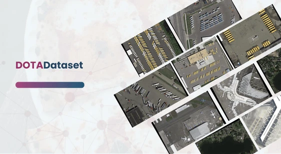
DOTA (Dataset for Object Detection in Aerial Images) is a large-scale, high-quality dataset specifically designed for object detection in aerial imagery. With its vast range of annotated objects and varying environmental conditions, DOTA has become an essential resource for researchers and developers in the field of aerial image analysis. The dataset allows the development, training, and evaluation of object detection models, offering realistic data that reflects the challenges faced in real-world scenarios.
DOTA’s data is derived from multiple platforms and sensors, covering urban, rural, and industrial landscapes. The imagery features objects with diverse sizes, shapes, orientations, and pixel densities, allowing models to generalize better to real-world applications. Each image in the DOTA dataset has a resolution ranging from 800 × 800 pixels to as large as 20,000 × 20,000 pixels. All objects are annotated by expert interpreters using an arbitrary quadrilateral representation, which offers precise localization, including object rotation and skew.
Download Dataset
Applications and Challenges:
The DOTA dataset is valuable for a wide variety of applications, including urban planning, disaster management, environmental monitoring, and defense-related activities. Given the wide range of object scales, orientations, and densities, DOTA is particularly useful for training models designed to work in challenging aerial image environments. The addition of extremely small objects and categories like airports and helipads in DOTA-v2.0 further enhances its applicability.
Challenges:
- Variability in Object Scale and Orientation: Objects in aerial images can appear at vastly different scales due to changes in altitude and perspective, making accurate detection challenging.
- Small Object Detection: DOTA-v1.5’s inclusion of extremely small objects (less than 10 pixels) presents a unique challenge for current object detection algorithms.
- High-Resolution Images: With images as large as 20,000 × 20,000 pixels. Efficient memory management and data processing become critical.
- Imbalanced Dataset: Certain object categories, such as buildings or vehicles, may dominate the dataset. Introducing challenges in balancing model performance across all categories.
Future Directions and Updates:
As the field of object detection in aerial images continues to evolve. The DOTA dataset will be updated to reflect these advancements. Future releases may include additional categories, more diverse geographical regions, and further improvements in annotation accuracy. Continuous contributions from the research community are encouraged to help expand and refine DOTA. Making it a truly comprehensive resource for aerial image object detection.
The flexibility and comprehensive nature of DOTA make it ideal for benchmarking modern. Object detection algorithms in aerial imagery, and its growing scope ensures its relevance in the ever-evolving AI landscape.
This dataset is sourced from Kaggle.
Contact Us

Quality Data Creation

Guaranteed TAT

ISO 9001:2015, ISO/IEC 27001:2013 Certified

HIPAA Compliance

GDPR Compliance

Compliance and Security
Let's Discuss your Data collection Requirement With Us
To get a detailed estimation of requirements please reach us.