
Lane Merging and fork Area Segmentation Dataset
Home » Case Study » Lane Merging and fork Area Segmentation Dataset
Project Overview:
Objective
We excel in collecting and annotating diverse datasets to drive the progress of machine learning models. Our most recent endeavor, the Lane Merging and Fork Area Segmentation Dataset, serves as a prime example of our proficiency in this field. Tailored specifically to bolster autonomous vehicle navigation, advanced driving assistance systems (ADAS), and research on traffic pattern recognition, this dataset represents a significant leap forward. Moreover, it provides invaluable resources for researchers and developers alike.
Scope
We excel in collecting and annotating diverse datasets to drive the progress of machine learning models. Our most recent endeavor, the Lane Merging and Fork Area Segmentation Dataset, serves as a prime example of our proficiency in this field. Tailored specifically to bolster autonomous vehicle navigation, advanced driving assistance systems (ADAS), and research on traffic pattern recognition, this dataset represents a significant leap forward. Moreover, it provides invaluable resources for researchers and developers alike.

Sources
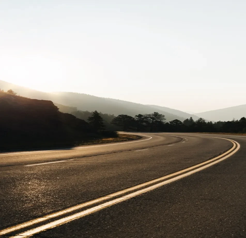
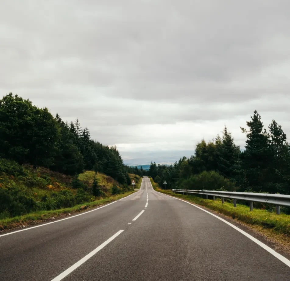
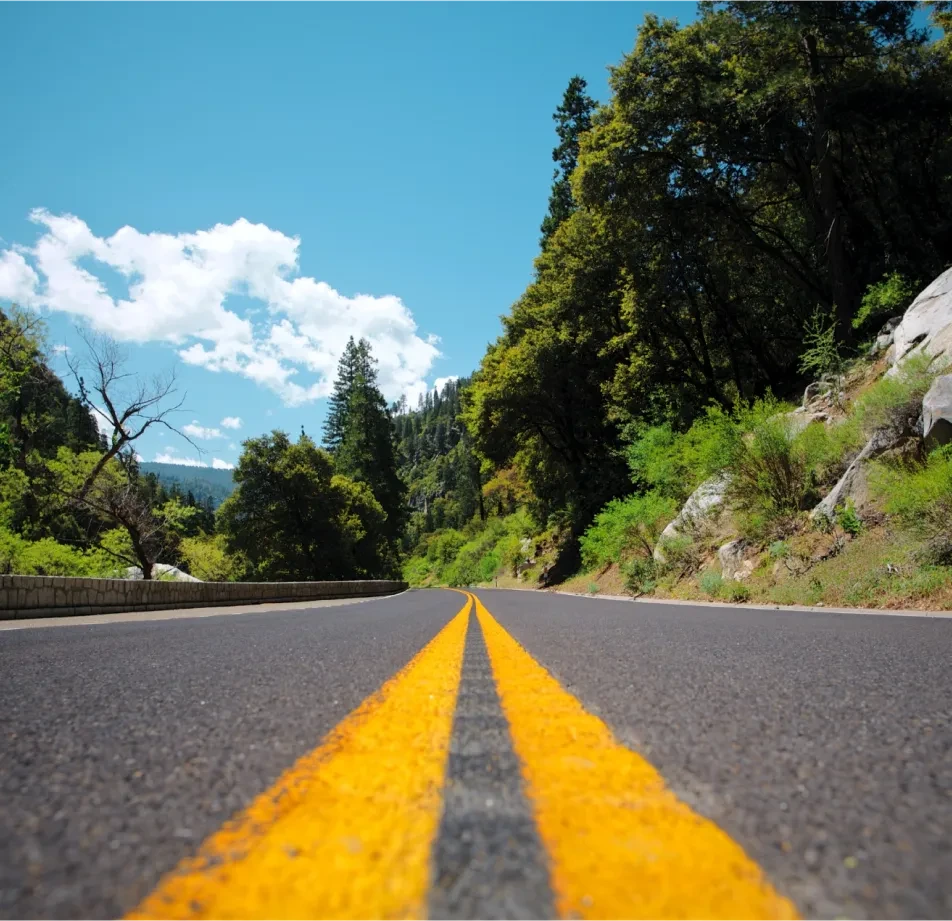
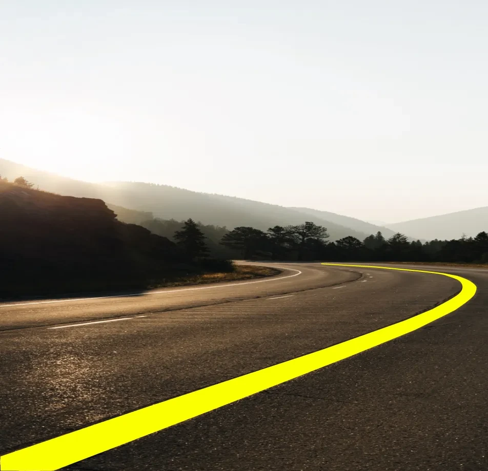
- Urban and rural roadways display a variety of merging and fork patterns. Moreover, these road networks incorporate a wide range of transition points, including intersections, divergences, and junctions.
- Daytime and nighttime environments to capture lighting variations. Transitioning from the bright hues of daylight to the moody tones of the night sky allows for a diverse range of photographic possibilities. By actively engaging with these contrasting environments, photographers can enhance their skills and produce captivating imagery that showcases the interplay of light and shadow.
- Aerial drone photography for a unique top-down view of merging/fork areas. Capture stunning aerial drone photography to provide a unique top-down perspective of merging and fork areas. With the drone’s high vantage point, it seamlessly navigates the airspace, allowing for unparalleled views of the intricate patterns where roads merge and diverge. Moreover, this perspective offers a fresh outlook on traffic flow dynamics, highlighting transitions and intersections with clarity and precision.
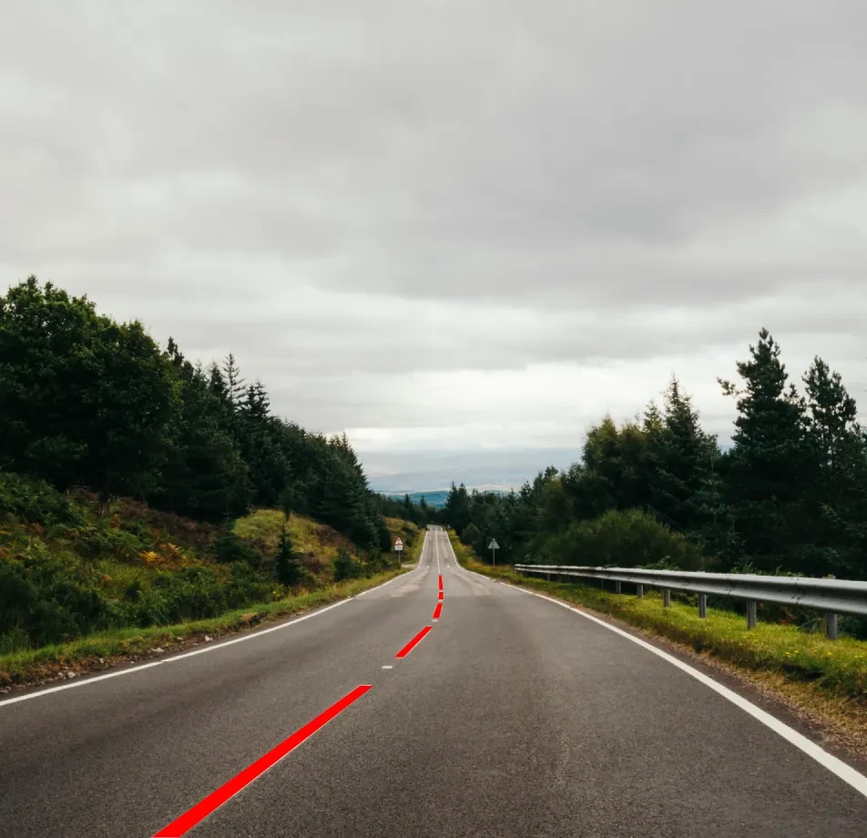
- Dashcam footage from vehicles, offering a driver’s perspective. Dashcam footage from vehicles provides a driver’s perspective. As the vehicle navigates through traffic, it captures real-time footage of the road ahead. Moreover, it offers crucial evidence in the event of accidents or disputes. Additionally, dashcams serve as a constant witness, documenting the driver’s actions and surroundings. Furthermore, they offer peace of mind to drivers, knowing they have a reliable record of their journeys.
- Traffic cameras, strategically positioned in various global cities, offer a broad spectrum of road structures. Additionally, they provide real-time insights into traffic patterns and conditions. These cameras actively monitor intersections, highways, and urban streets.

Data Collection Metrics
- Total Data Points: 500,000 images
- Urban Roadways: 250,000
- Rural Roadways: 100,000
- Night Captures: 50,000
- Drone Aerial Shots: 50,000
- Dashcam Recordings: 40,000
- Traffic Camera Captures: 10,000
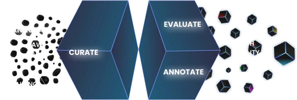
Annotation Process
Stages
- Initial Steps: We initiated the process by refining raw data, meticulously selecting only the most relevant and clear images that focus on our target areas.
- Primary Road Segmentation: Moving forward, we tackled the primary road segmentation, actively defining the overall road boundaries.
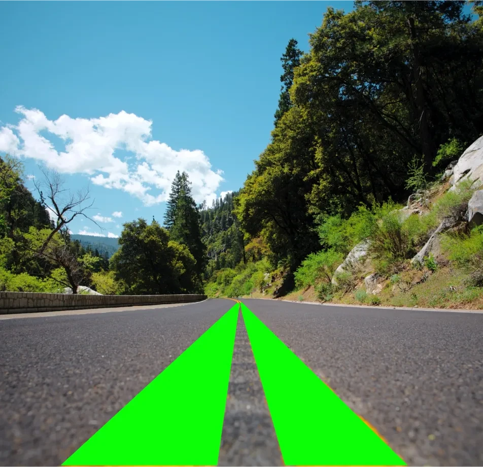
- Detailed Annotations: Subsequently, we delved into detailed annotations, meticulously segmenting and labeling merging and diverging lanes, including signage, road markers, and related infrastructure.
Annotation Metrics
- Primary Road Segmentations: 500,000
- Merging/Fork Annotations: 500,000
- Signage and Marker Annotations: 300,000
- Annotations Reviewed: 100,000 (20% of total segmentations for quality assurance)
Quality Assurance
Stages
- Expert Review: Urban planners and traffic management experts meticulously verified our annotations.
- Automated Consistency Checks: Additionally, advanced software tools were employed to identify and rectify potential inconsistencies automatically.
- Inter-annotator Consistency: Moreover, our team of annotators worked in tandem on overlapping datasets to maintain uniform standards, fostering inter-annotator consistency.
QA Metrics
- Annotations Verified by Experts: 110,000 (20% of total annotations)
- Inconsistencies Detected and Corrected: 11,000 (2% of total annotations)
Conclusion
The Lane Merging and Fork Area Segmentation Dataset is meticulously crafted to serve as an indispensable asset in the evolution of autonomous vehicle technology and intelligent traffic systems. By systematically capturing and annotating complex road configurations, we furnish a robust foundation for developing safer and more efficient navigation solutions in the rapidly evolving world of transportation. Moreover, our dataset not only facilitates the advancement of autonomous driving but also enhances the effectiveness of traffic management strategies.

Quality Data Creation

Guaranteed TAT

ISO 9001:2015, ISO/IEC 27001:2013 Certified

HIPAA Compliance

GDPR Compliance

Compliance and Security
Let's Discuss your Data collection Requirement With Us
To get a detailed estimation of requirements please reach us.